The mountain as a network
A ski area is a graph. Lifts are edges that go up, pistes are edges that come down, and each one carries a grade and a state. Route across that graph and the question stops being how far it is and starts being what it puts under your skis on the way.
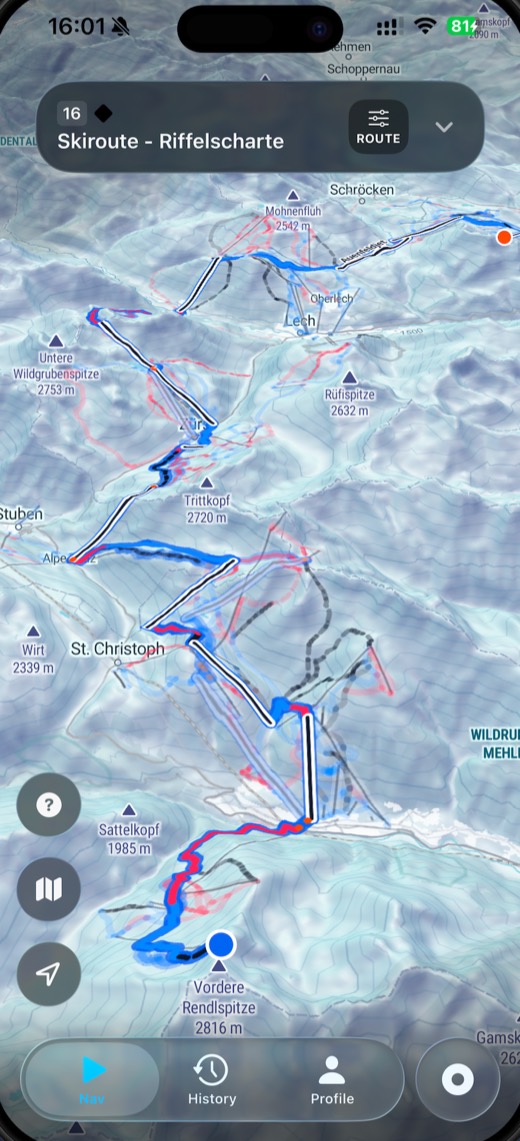
Most mapping apps draw the pistes and leave the joining up to you. SkiAllDay solves the route: it takes where you are, where you want to be and the hardest grade you are willing to ski, and returns a sequence of lifts and runs that gets you there without exceeding it. Ski routes are in or out on the same terms.
The network it solves is the one that exists this morning, not the one on the printed panorama. A closed lift or a roped-off run is an edge the router cannot use, so it goes round instead of walking you to the rope and leaving you there. Where the mountain offers more than one answer it gives you more than one: the direct line, the easier line, the one with fewer lift rides. Change the limit, or wait for a lift to open, and the whole set changes with it.
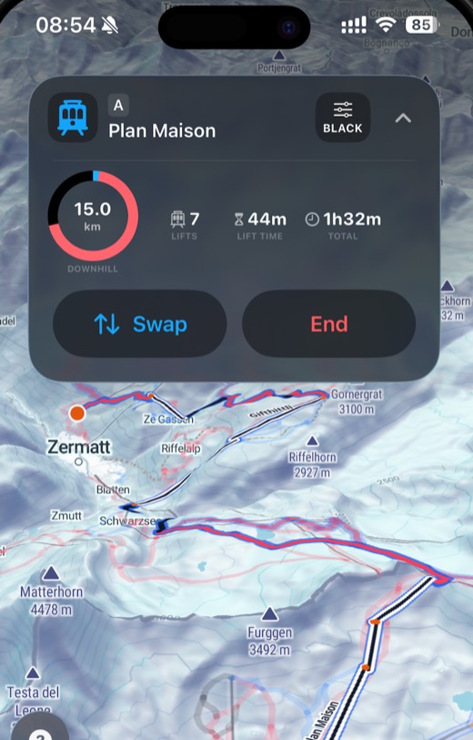
Limit: black
Down the fall line: one black pitch, then two reds. Three runs to the valley.
Limit: blue
The same village without leaving a blue, by a longer way round the mountain.
Limit: black, one run shut
The direct run is closed today. Same limit and the same village, one junction further round.
- Easy
- Intermediate
- Difficult
On the phone
A day that comes back run by run
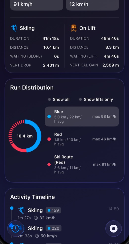
Recording is automatic, and what comes out of it is matched to the mountain. Lifts, descents and the transitions between them are detected as you ride, then resolved against the runs and lifts of the area you are in.
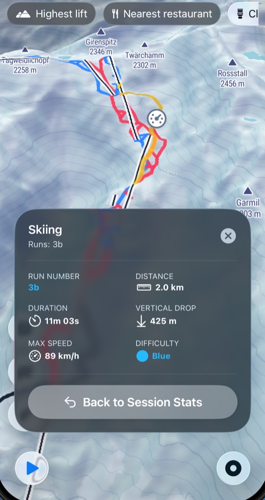
The difference shows up when you look back at a day. A GPS track gives you a line and a total. A matched session gives you the third run of the morning by its own number, with the distance, the vertical, the time and the speed you carried down it — and tapping it opens the map at the place it happened.
- Distance
- Downhill and on lifts, separately
- Vertical drop
- Per run and for the day
- Runs
- Matched to the named piste
- Lift rides
- Counted, with time spent riding
- Top speed
- For the day and per segment
- Waiting
- Time standing at lifts
Where it works
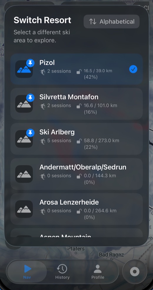
1,311 ski areas in 48 countries are mapped in the app, from the big linked Alpine networks down to hills with a single drag lift. Switch between them in the app; a season of days compares across all of them.
| Country | Ski areas | Piste km | Lifts | Highest lift |
|---|---|---|---|---|
| United States | 238 | 8,709 | 2,235 | 3,910m |
| Austria | 158 | 5,738 | 2,329 | 3,424m |
| Italy | 143 | 4,988 | 2,183 | 3,872m |
| France | 140 | 7,596 | 3,172 | 3,511m |
| Switzerland | 122 | 4,247 | 1,663 | 3,872m |
| Canada | 96 | 2,928 | 558 | 2,686m |
| Japan | 96 | 1,419 | 755 | 2,300m |
| Norway | 42 | 820 | 381 | 1,441m |
| Sweden | 32 | 784 | 453 | 1,274m |
| Germany | 30 | 556 | 407 | 2,676m |
| Spain | 26 | 910 | 366 | 3,301m |
| China | 22 | 526 | 186 | 3,381m |
The twelve countries with the most areas in the app. A ski area on a border is counted in each country it touches, so these rows add up to more than the corpus holds. Linked countries have written guides; the rest are in the app without one.
Guides to the mountains themselves
Alongside the app, this site publishes measured guides to individual ski areas. They lead with figures taken from the resort’s own lift and piste network rather than its brochure: how much piste each kilometre of lift opens up, how much of an hour on the hill goes on riding lifts, which way the slopes face. Where the resort publishes its own numbers, both are shown.
What is in the app
- Resort mapsEvery mapped area in 2D or 3D, searchable for pistes, lifts, restaurants, huts and other points of interest.
- Network routingRoutes solved across the whole lift and piste network, not just the run you are standing on.
- Difficulty limitsEvery route held to the hardest grade you are willing to ski, junction by junction.
- Live lift and piste statusClosed lifts and runs come out of the network, so a route is one you can ski today.
- Alternative routesWhere the mountain offers more than one way, more than one is offered back.
- Ski routes and backcountryMarked ski routes can be included in a route or left out of it.
- Automatic session recordingLifts, descents and the transitions between them are detected as you ride.
- Run matchingRecorded movement resolved to the named runs and lifts you took.
- Session statisticsDistance, duration, vertical drop, lift rides, lift time, top speed and waiting periods.
- Segment detailSpeed and timing for each individual run and lift ride.
- Map playbackAny run in a summary opens back at the place on the map where it happened.
- Season comparisonDays compared over time and across different resorts.
- Coverage trackingHow much of a resort you have skied, built up over a season.
Questions
What does the routing actually do?
It treats the ski area as a network of lifts, pistes and ski routes and finds a way through it under the constraints that apply. Cap the routing at blue and it will take a longer chain of easy runs and an extra lift rather than put you on a red. Open it up to ski routes and it will use them. The point is that the grade of every pitch on the way is part of the calculation, not something you discover at the top.
Does it know what is open?
Lift and piste status feeds the same network the router solves, so a closed lift or a roped run is an edge it will not use. You get a way round rather than a line that stops at the rope, and where the mountain allows more than one way round you get more than one to choose between.
How is this different from a GPS tracking app?
Two things. It plans as well as records, and what it records is matched to the mountain. A GPS app gives you a breadcrumb line and a total. SkiAllDay resolves that line into the runs and lifts you actually took, so a day comes back as a list of named runs with a distance, a vertical drop and a top speed against each one.
Which ski areas does it cover?
1,311 ski areas across 48 countries are mapped in the app, from the large linked Alpine areas down to single-lift hills. A growing number of them also have a written guide on this site, measured from the resort’s own lift and piste network.
Does it work for snowboarding?
Yes. Routing and tracking work the same either way, and the grade constraints are about the pitch rather than the equipment.
Can I see the mountain in 3D?
Yes. The map renders in 2D or 3D, and you can search it for pistes, lifts, restaurants, huts and other points of interest.
What does a recorded session give me?
Distance, duration, top speed, vertical drop, lift rides and time spent on lifts, plus segment-level detail including speed and the periods you spent waiting. Any run in the summary opens back at the place on the map where it happened, and days can be compared across resorts and across a season.